Setting a New Benchmark for Aerial Intelligence in Vienna
Welcome to the Vienna regional operations hub of Fair Lifts Unmanned Aerial Services. Rooted in the industrious landscape of Dooly County, we understand that bridging the gap between sophisticated robotics and local agricultural heritage is essential for a thriving regional economy. Vienna is far more than a waypoint on the I-75 corridor; it is a vital engine for Georgia’s cotton and peanut production. From the historic streets of downtown to the sprawling industrial sites near the rail lines, Fair Lifts delivers the technical infrastructure that empowers Dooly County enterprises to optimize their yields and modernize their operations.
Our philosophy centers on turning raw data into decisive action. For many years, drone technology was relegated to the realm of simple photography—visuals that looked nice but failed to move the needle on a balance sheet. Fair Lifts is rewriting that script. We have transitioned the Unmanned Aerial Vehicle (UAV) from a peripheral gadget into a cornerstone of industrial infrastructure. With a background steeped in rigorous aviation standards and complex project management, we ensure every flight over a Vienna job site is conducted with pinpoint accuracy and a localized understanding of the Coastal Plain’s unique environmental variables.
Cultivating Success in Dooly County’s Soil
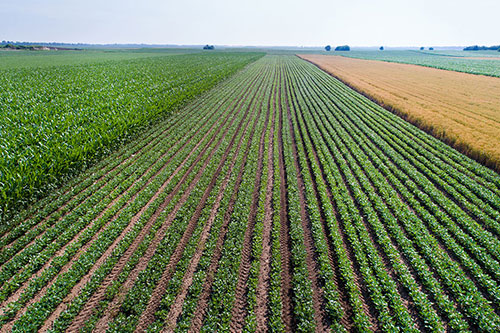
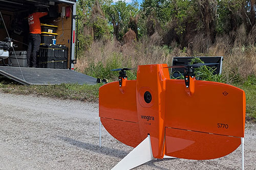
In Vienna, agriculture isn't just a business; it’s the community's backbone. Local producers manage some of the most intensive cotton, corn, and peanut operations in the Southeast. However, the Coastal Plain’s characteristic sandy loam and unpredictable humidity introduce significant operational hurdles. When the heavy summer deluges of South Georgia turn fields into saturated mires, traditional ground rigs are sidelined, leaving crops vulnerable to rapid pest and disease outbreaks. Fair Lifts provides the solution. As "Aerial Access Specialists," our heavy-payload spray drones operate regardless of ground conditions, delivering essential crop protection to every acre exactly when the biological window is narrowest.
Our mission also extends to the preservation of South Georgia’s natural landscape. The Flint River watershed is an invaluable ecological asset, and its maintenance requires surgical precision. Our environmental management team focuses on the targeted eradication of invasive flora like Kudzu and Chinese Tallow without the heavy-handed soil compaction or habitat disruption caused by traditional machinery. By leveraging high-resolution multispectral sensors, we identify infestations with centimeter-level clarity, ensuring our interventions are both environmentally responsible and highly effective. We aren't just flying over Dooly County; we are investing in its long-term sustainability.
Superior Geospatial Analytics and Mapping
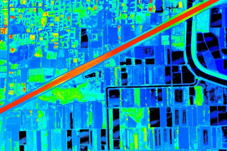
As Vienna and the surrounding areas experience new industrial and logistical growth, the requirement for high-fidelity geospatial data has never been more pressing. Whether it’s site preparation for a new distribution facility near Unadilla or high-voltage line inspections for regional co-ops, there is zero tolerance for inaccuracy. Fair Lifts Survey & Mapping Services provides the absolute horizontal and vertical data integrity that engineering-grade projects demand. Utilizing Blue UAS-cleared platforms and RIEGL LiDAR technology, we penetrate the thickest Georgia pine canopies to generate millions of precise data points.
Furthermore, we are committed to the highest standards of data security for our Vienna partners. In an era of heightened digital risks, we prioritize the protection of regional infrastructure intelligence. Our Blue UAS status confirms that our equipment and data handling meet stringent Department of Defense requirements for supply chain security and encryption. Whether we are mapping a Dooly County substation or a municipal water project, your proprietary data remains secure from takeoff to final delivery. We provide more than just topographical maps; we provide the certainty required for high-stakes decision-making.
We invite you to discover how Fair Lifts is elevating the economic potential and the skyline of Vienna, GA. Our specialized team of agronomists, project leads, and Part 107 pilots is ready to design a solution for your most complex aerial challenges. In Dooly County, we don’t just watch the horizon; we master it.
Regional Performance
Local Rapid Mobilization
Our specialized crew is based in the region, offering 24-hour response times for Dooly, Crisp, Wilcox, and Pulaski counties.
Request Local Response
Ready to Start Your Project?
Discuss your specific goals in Vienna with a regional expert. We provide rapid mobilization and precision scoping for every regional client.